[category]
[title]
Slow Ways wants to ‘connect every town, city and national landscape in Britain’ and make rural walking accessible to all


A really good hike takes planning. Whether a walking route can get you from A to B is just the start of it – you want to set off knowing that you’ll actually have a nice time along the the way. That means finding out stuff like what kind of views it offers, the kind of shoes it requires, whether you can roll a pram along it or if there’s a decent pub for fuelling up on pints. That’s where a new citizen-made walking network called Slow Ways comes in.
Slow Ways was created by geographer and walking fanatic David Raven-Ellison. It was born as an initiative in 2020 with a mission to ‘connect every town, city and national landscape in Britain through thoughtfully designed walking routes’ and make the great outdoors more accessible for people with disabilities, parents with children and older people.
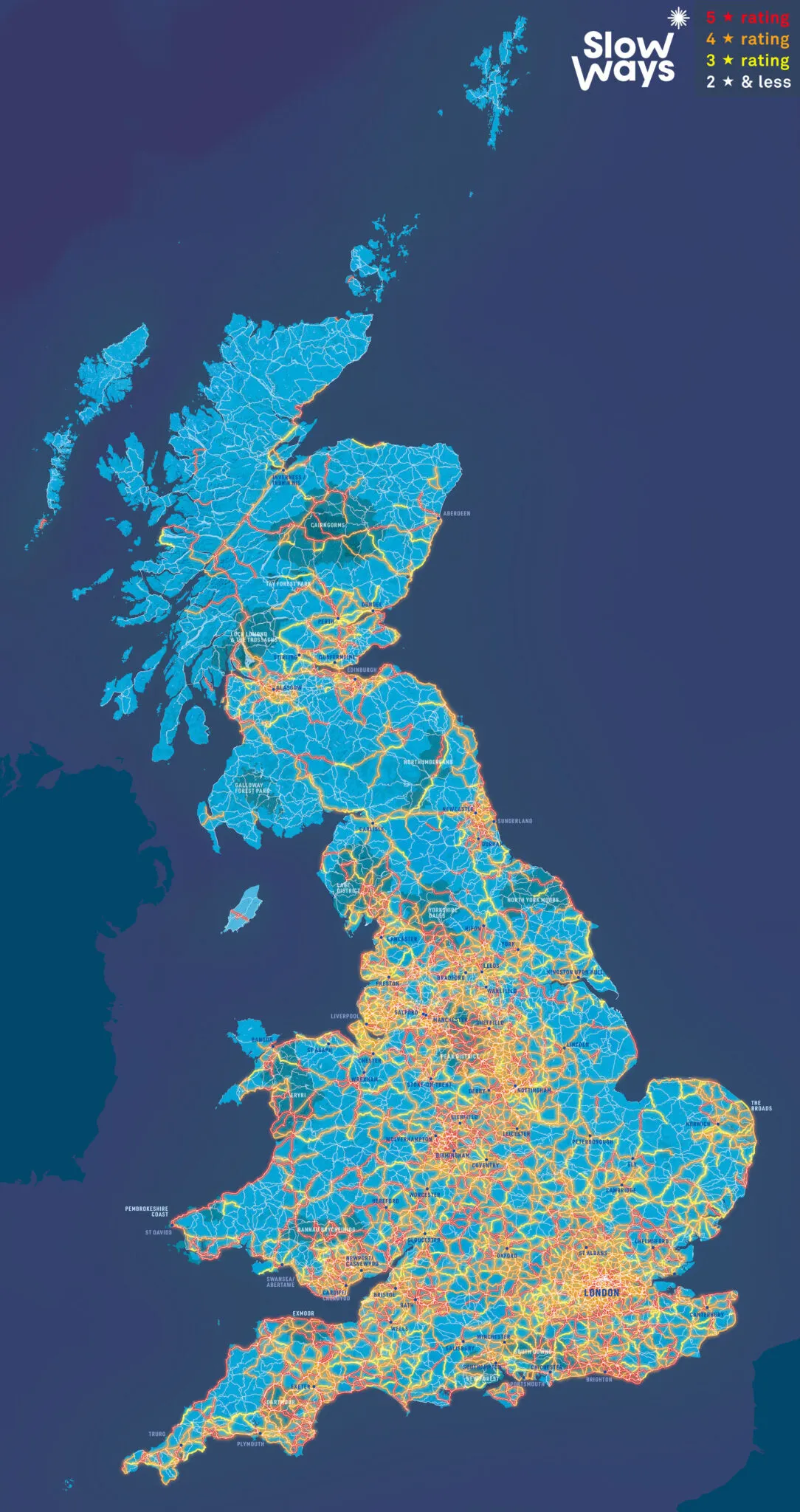
With help from thousands of volunteers, who have recommended trails with reviews and practical advice over the past five years, there are now 10,000 walking and wheeling routes (spanning 140,000km of the UK) to be discovered on the site. Nearly 7,000 of those come with one or more reviews and more than 5,700 of them have a rating of three to five stars. Slow Ways says that you can walk between Inverness, Penzance, Bangor and Dover entirely on the 4,254 routes (50,000) rated four or five stars. Take a look at the routes on the map below.
Raven-Ellison told the Guardian: ‘For millions of people, these routes give the psychological security and confidence that they would not have had otherwise. They do not want to take the risk of not knowing whether a route is right for them, or if it is something they will enjoy.’
But Slow Ways wants to take things to the next level. With ambitions to reach one million routes, it said: ‘We’ve connected every town and city with possible routes. Now let’s connect every hamlet, neighbourhood, village and public service, shop, beach, hilltop, park and forests – with long, short, micro, linear and looping routes.’
It’s now developing an app that’ll offer extra information like if a route is wheelchair accessible, whether you can spot animals along the way, and whether your shoes are at risk of getting muddy. There will also be a bunch of special-interest routes included on the app, some of which will be ‘super-niche’. Slow Ways promises that there’ll be ‘heritage trails, ancient tree treks, the best local couch-to-10K runs, wellbeing rides, year seven geography field adventures, fully accessible circular adventures and more’.
If you’re into the idea, Slow Ways invites you to chip in over on its Crowdfunder. At the time of writing it has raised just over £71,000 of its main goal of £250,000 – which will allow it to roll-out nationally. The Crowdfunder closes at 8pm on August 31.
Discover the route that was recently named the best walk in Britain.
And explore Time Out’s round up 13 most breathtaking hikes in the UK right here.
Stay in the loop: sign up to our free Time Out UK newsletter for the latest UK news and the best stuff happening across the country.
Discover Time Out original video