[category]
[title]
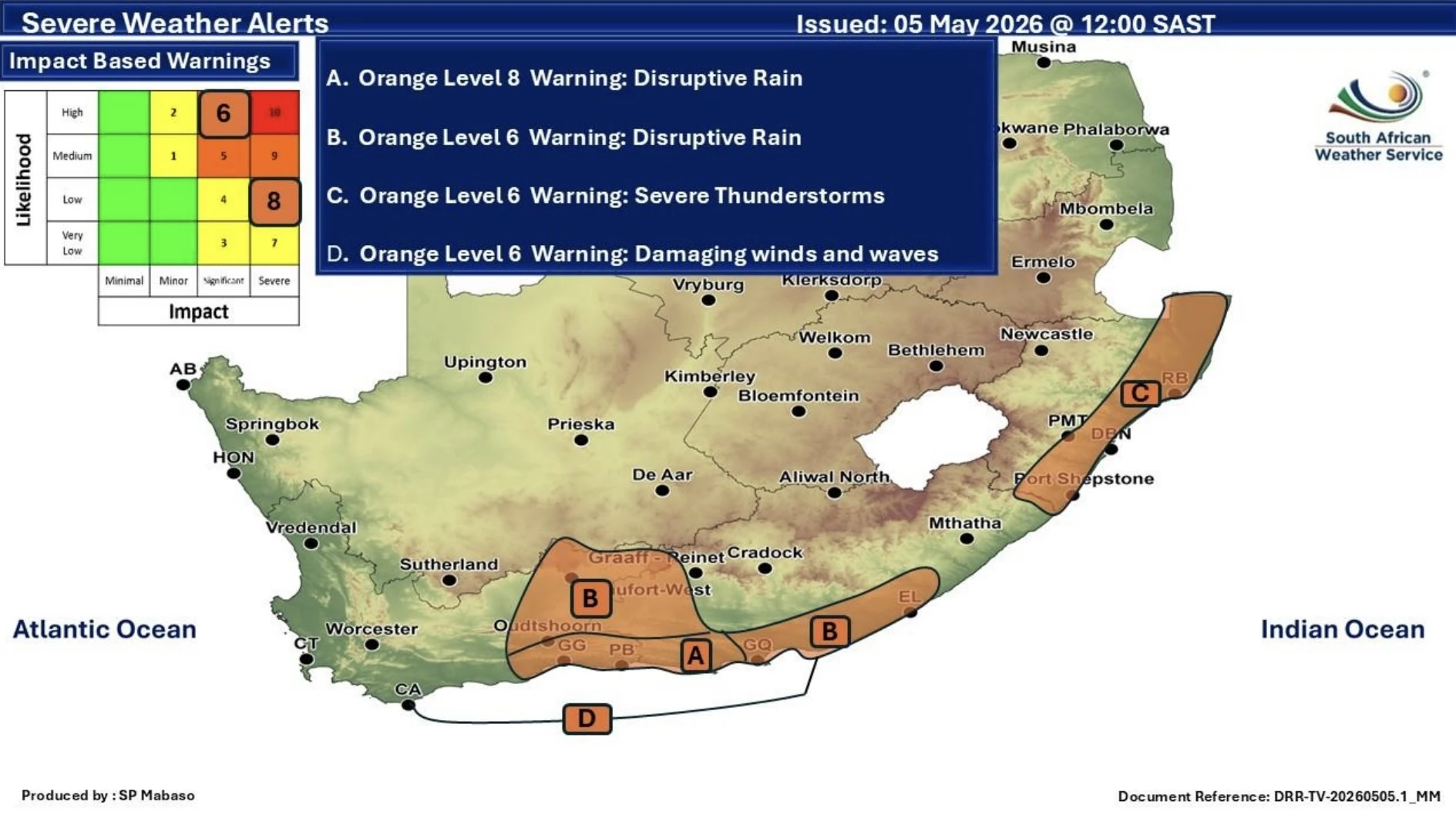
The Garden Route is on alert for severe flooding, while snow is expected in the high-lying regions of the Western Cape.


The Western Cape is in the firing line as an intense cut-off low sweeps across South Africa this week. Expect a chaotic mix of heavy rain, plunging temperatures, strong winds, and even snow!
According to the South African Weather Service, conditions will peak between today and Thursday (First Thursdays in the Mother City far from cancelled though). The Garden Route, specifically, is on high alert for disruptive rainfall and potential flooding.
An Orange Level 8 warning has been forecast for parts of the Garden Route, with torrential downpours expected to flood roads, damage settlements, and isolate communities.
If you're in the area, avoid flooded roads and swollen rivers, as fast-moving water can be dangerous.
While coastal areas of the province brace for rain, inland high-lying regions could see snowfall from Wednesday evening. Roads and mountain passes across the north-eastern Western Cape, and into the Eastern and Northern Cape, could be impacted.
Time Out Tip: Feeling brave? Here's where to snow hunt this winter safely!
Damaging winds and rough seas are forecast between Cape Agulhas and Cannon Rocks, with disruption for small harbours and coastal navigation over the next few days.
What you should do:
Conditions are expected to ease from Friday, but the cold snap may linger into the weekend. Stay safe, stay informed, and maybe keep the gumboots handy.
Follow Time Out Cape Town on Facebook, Instagram and TikTok! And make sure you sign up to Time Out Cape Town's free newsletter for expert recommendations on new things to do, see, eat and drink in the Mother City.
Discover Time Out original video