[category]
[title]
Two cold fronts are bringing heavy downpours, rough seas and a dramatic sky show over Table Bay


We were never ready for summer to end! And with a jam-packed weekend of things to do, from the Stormers Rugby at the DHL stadium and an ever-popular SA Navy festival, the Cape Town weather is not playing along.
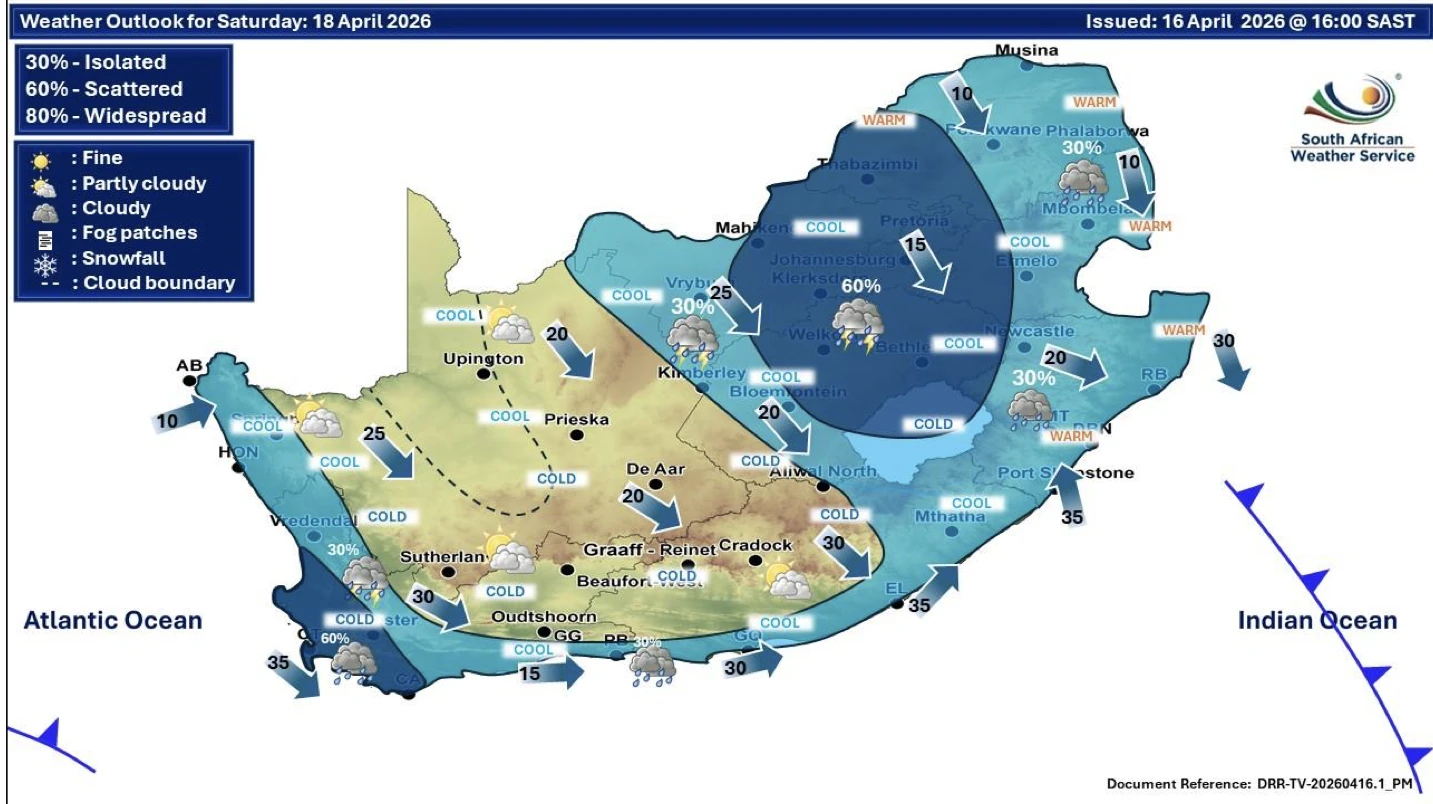
The South African Weather Service has warned of two cold fronts sweeping across the Western Cape, bringing heavy rain, strong gusts and flashes of lightning. The first cold front is already making its presence felt and will continue through to Monday, along with a sharp temperature drop and rough coastal conditions. Waves are expected to reach up to 5 metres, so the ocean is very much off-limits - not great for the Noordhoek Beach warning, following a dangerous lagoon break on Thursday.
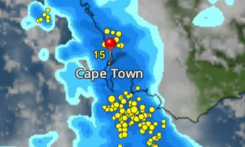
Local climatologist Weather Man Pete suggests the second system arriving on Sunday could pack the biggest punch, with heavier rain, gusty winds and possible lightning strikes lighting up the skies!
"Let's hope the rain all heads damwards! The yellow dots in the rain image are expected lightning strikes. Enjoy the sudden winter this weekend!"
ALSO SEE: The (thirsty) story behind the Table Mountain dams
Not ideal timing. With Stormers rugby at DHL Stadium and the SA Navy Festival on the lineup, expect wet seats, muddy grounds and plenty of dashes for cover. Roads could get slippery, visibility may drop, and low-lying areas could see some localised flooding.
The only upside? If the clouds break just right, Sunday could deliver a dramatic lightning show over Table Bay (if you're keen to brave the elements).
According to the South African Weather Service the following impact can be expected:
A Noordhoek lagoon breakout and beach warning is still in place after the National Sea Rescue Institute responded to a near-drowning in the area yesterday, as conditions were dangerous due to the incoming tide. Avoid the northern section near the car park, keep kids and pets well clear of the water, and do not attempt to cross the channel.
View this post on Instagram
Clearly not a weekend for the beach, but instead a weekend for raincoats, hot drinks and staying dry where you can!
Head over to our social media channels to follow Time Out Cape Town on Facebook, Instagram, and TikTok. And don't forget to sign up to Time Out's free newsletter for expert recommendations on new things to do, see, eat and drink in the Mother City.
Discover Time Out original video