[category]
[title]
Motorists are being urged to delay travel as the Road Traffic Inspectorate activates its snowfall response plan and closes roads in parts of KZN.

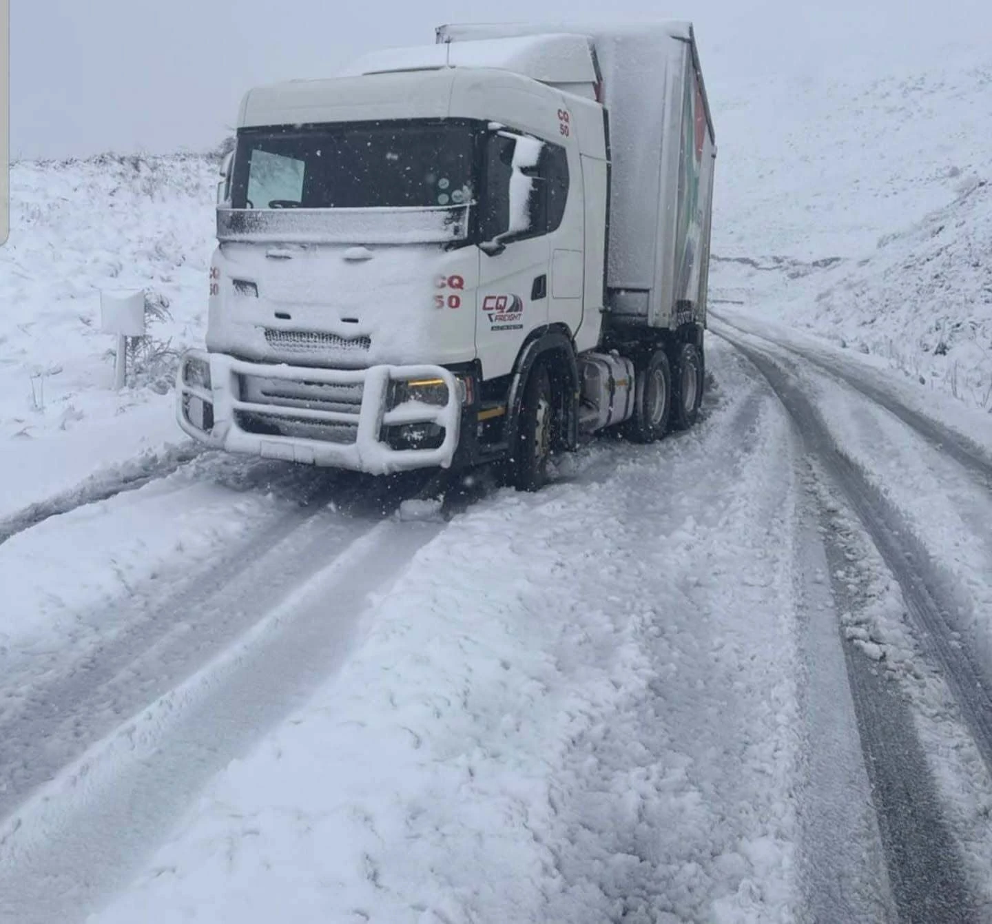
Road closures have been reported in Kokstad, Kingscote and Underberg, with the R617 currently closed and traffic being redirected to the R56.
RTI has also reported that a truck is currently stuck on the R617 in Kingscote, highlighting the potentially hazardous conditions facing motorists in affected areas.
The provincial authorities are urging motorists and members of the public to stay off the roads where possible.
“We are requesting motorists to delay their trips and members of the public to remain indoors, as prevention is better than cure,” says the MEC for Transport and Human Settlements Siboniso Duma.
KZN's Snowfall Response Plan is designed to prevent snow from accumulating to dangerous levels on provincial roads.
According to the provincial transport authorities, graders have already been activated to clear snow before it reaches depths of more than 30cm.
The response is particularly important on mountain routes and other roads where snowfall and freezing temperatures can quickly make driving conditions dangerous.
And it's not just the snow itself that's a concern. Engineers have warned that when water and ice seep into existing cracks in roads and subsequently freeze, the expansion can turn those cracks into larger potholes.
For motorists, that means even roads that remain open could present additional hazards as the weather deteriorates.
With the R617 closed and a truck already stuck on the route, today is not the day to take unnecessary risks for the perfect snowy photograph.
Authorities say the increasingly erratic weather patterns being experienced across the province – from extreme heat and heavy rainfall to snowfall – are creating additional challenges for road infrastructure and transport planning.
For now, the advice is simple: if you don't need to travel through affected areas, stay put and let the road crews do their work.
The predicted cold front has arrived… in case you hadn’t noticed!
Along with the cold front is an associated upper-air system that’s moving across the country, bringing cold, wet and windy conditions to KwaZulu-Natal.
And with the long weekend ending today, the timing means plenty of people will be on the roads today, so if you’re travelling, take precautions.
READ: Kelvin Momo to headline Durban's biggest Heritage Day shisanyama festival
Along the coast, conditions are expected to be considerably colder, with rain and showers developing along parts of the coast and stronger winds at times.
The system is also expected to produce rough sea conditions, with SAWS warning of potentially damaging waves along the coastline.
eThekwini Municipality has urged residents to remain cautious as adverse weather conditions move through the region.
The city's history with disruptive rainfall means motorists and residents in vulnerable or low-lying areas should pay particular attention to official weather and municipal alerts.
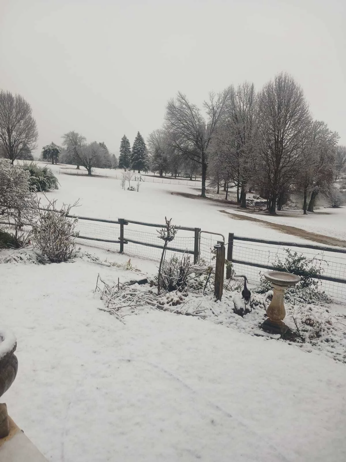
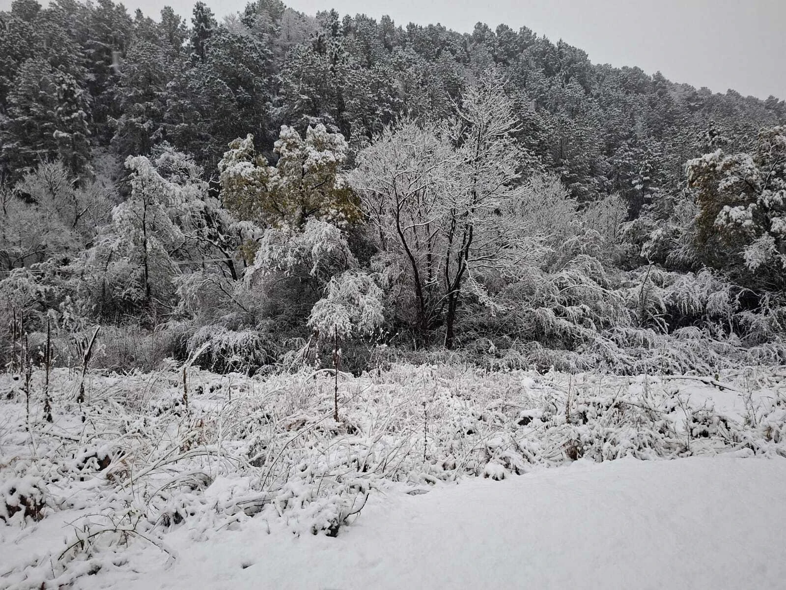
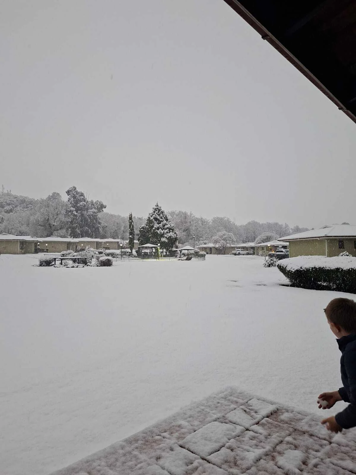
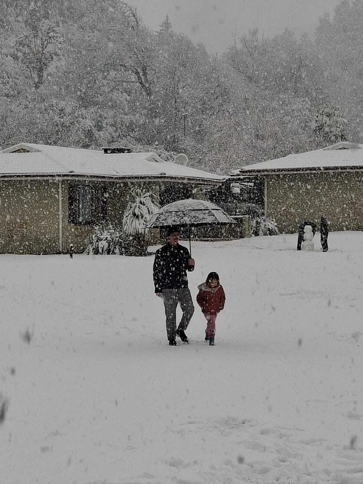
And yes, there is snow… further inland, of course.
SAWS warned that snow is possible over the mountainous areas of KwaZulu-Natal, as well as parts of the Free State and Mpumalanga... and they were right!
The higher-lying areas of KZN are therefore likely to see the biggest impact from the cold, with snow potentially affecting mountain passes and travel routes.
READ: Eat your way around the world at the Durban Street Food Festival
eThekwini Municipality has warned about the potential for localised flooding, particularly around low-lying areas, roads, bridges and informal settlements following persistent rainfall.
Strong winds could also bring down trees, damage roofs and infrastructure, cause power interruptions and create hazardous driving conditions.
Further inland, SAWS warns that snow and ice could affect mountain passes and potentially lead to road closures or transport disruptions.
If you're heading from Durban towards the KZN Midlands, Drakensberg or other inland destinations today, conditions can change quickly as you gain altitude.
Keep an eye on weather and traffic updates before setting off, and avoid travelling where possible!
The warm spell this week might’ve given us a taste of spring, but winter definitely isn’t done with KZN yet.
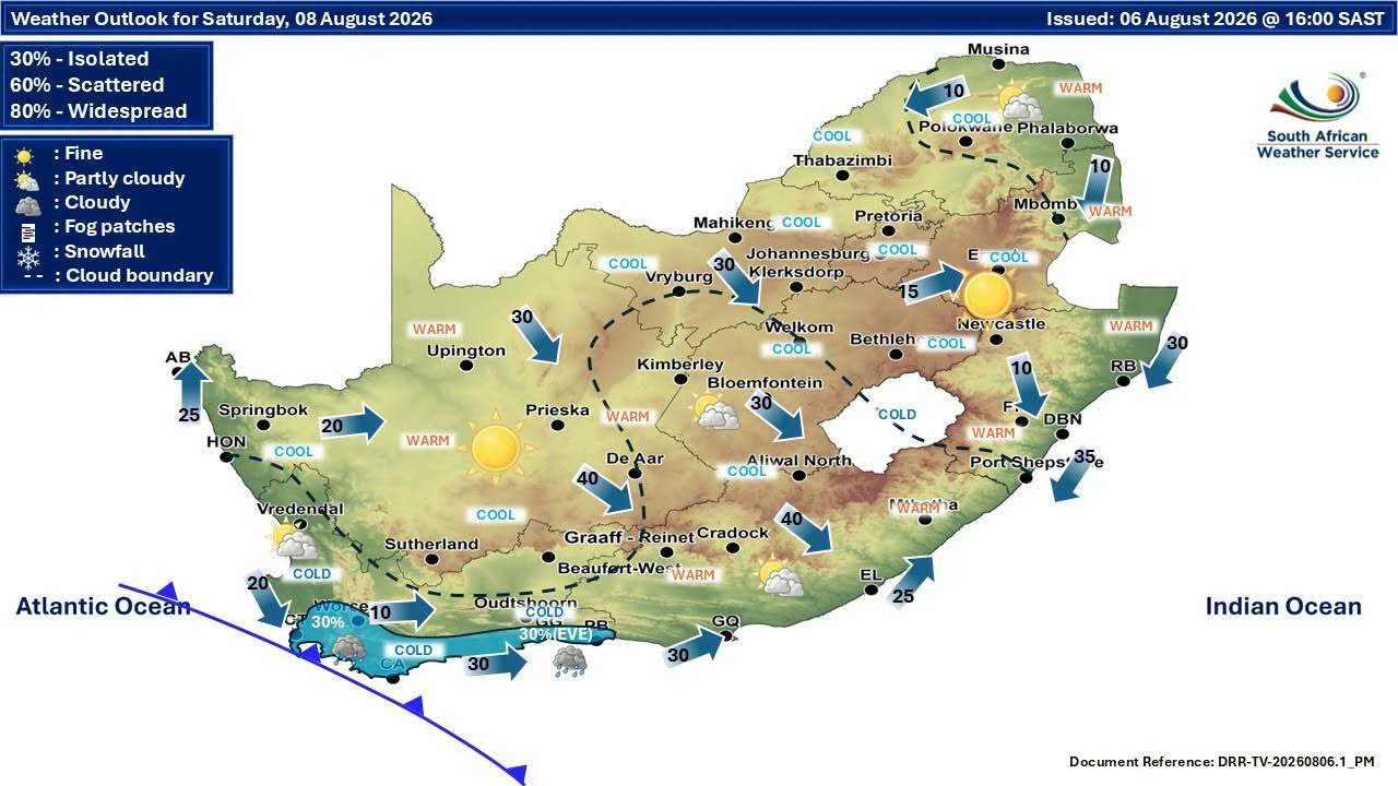
The South African Weather Service (SAWS) has issued a warning ahead of the long weekend, with a cold front and associated steep upper-air trough expected to make landfall over the Western and Northern Cape on Sunday, 9 August.
As the system moves eastwards, the cold, wet and windy conditions are expected to spread towards the Eastern Cape and then further inland.
For Durban, that means Sunday and Monday are likely to feel considerably colder than earlier in the weekend. Coastal KwaZulu-Natal can also expect rain and showers as the weather system develops.
So, if you're planning an outdoor long-weekend adventure, remember to pack your winter woollies!
READ: Hilton Arts Festival to host its first-ever art fair
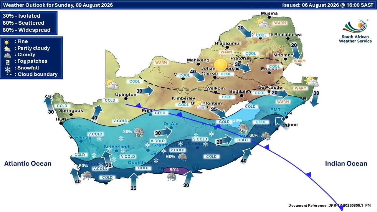
On Monday, 10 August, the upper-air trough is expected to deepen as it moves across the central and eastern parts of the country.
SAWS expects the system to bring cold to VERY cold conditions, rain and showers further inland, with scattered to widespread rain and showers over the southern parts of the country.
And yes, there could be snow!
Snow is expected over the mountainous areas of KwaZulu-Natal, the Free State and Mpumalanga, with a lower probability of light snow over some other higher-lying areas.
This follows last week’s powerful cut-off low that brought widespread rain, plummeting temperatures and snowfall to parts of the province.
This latest system is expected to bring another round of challenging winter weather, although the exact conditions will vary considerably across the province.
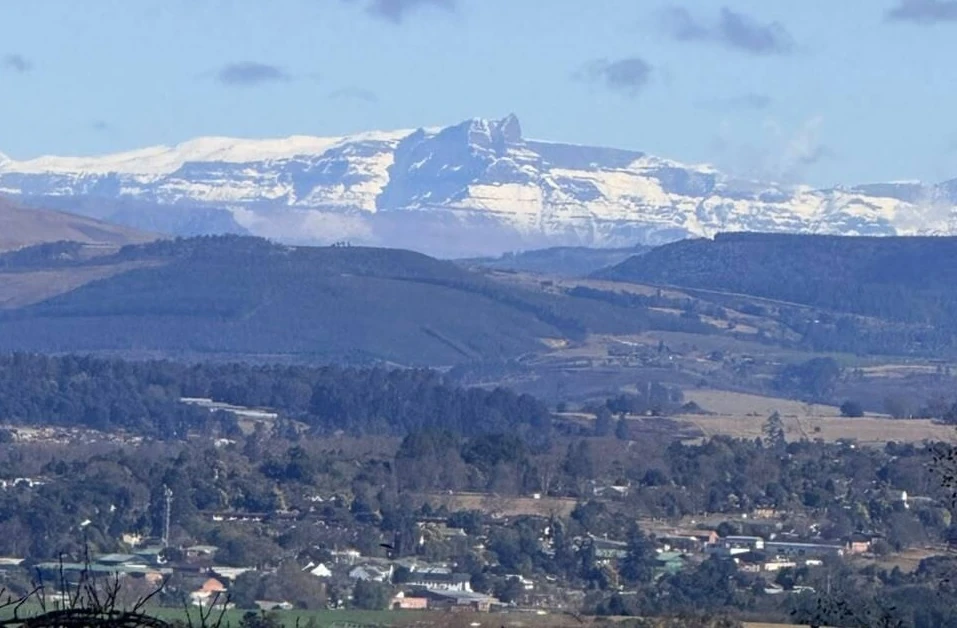
READ: Snowfall spotted on the Drakensberg
This isn't simply a case of a chilly weekend. SAWS has highlighted several potential impacts associated with the approaching system, including:
While the most severe cold is expected inland, Durban is likely to be impacted as well. We can expect:
If you're heading to the KZN Midlands for the Hilton Arts Festival, or the Drakensberg for a long weekend getaway – pack for the COLD and watch those weather warnings.
Check road and weather conditions before setting off, particularly on Monday.
TIME OUT DURBAN RECOMMENDS:
📍 The best things to do in Durban
🍽 The best restaurants in Durban
🏨 The best hotels in Durban
🛏️ Where to stay in Durban
📢 Latest news from Durban
Follow Time Out Durban on Instagram, Facebook and TikTok! To get the coolest news, features, and things to do straight to your inbox, sign up for our newsletter.
Discover Time Out original video