
[title]
Brooklynites are already dreading the L train shutdown that's scheduled to start at the beginning of 2019. But with the advanced warning, residents of the borough have at least been able to mentally and physically prepare for this massive 18-month project.
Thankfully, someone is two stops ahead of us and thought of a pretty ingenious way for New Yorkers to prepare for the shutdown ahead of time. New York-based start-up, Sidewalk Labs, has teamed up with the transit authority to help commuters find an alternative mode of transportation for when that frightful time finally comes.
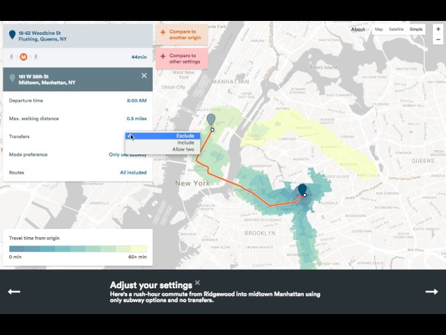
The map is officially called the NYC Transit Explorer, and the technology pulls in existing feeds regarding the status of various transit options. In a statement, Sidewalk Labs explains the need for this product:
“Users can explore accessibility from a given origin based on a range of variables, including departure time, max walking distance, and transfer and mode preference. You can also compare accessibility from two different points (especially useful if you’re planning to move and deciding between two neighborhoods), or from the same point with different settings. Inspired by TransAlt’s request, you can see what happens in a world without L train stops in Manhattan. You can also see how access improved with the opening of the Second Avenue subway.”
Take a look at the map here and see how to use the tool in the handy YouTube tutorial below.
MTA, we appreciate all the tools to help us maneuver around our beloved city, but what we would appreciate even more would be a decrease in subway fare and a hard ban on individuals who use the subway as a bathroom.