

[title]
Small businesses are truly taking a hit right now, and we all want to do what we can to show them support so they're able to reopen in the future. A few local New York organizations, including Taste Brooklyn and East Village Community Coalition, have created user-friendly interactive maps that can tell you which of your favorite spots are still open for business including bakeries, delis, restaurants, butcher shops, wine bars, breweries, laundromats and more.
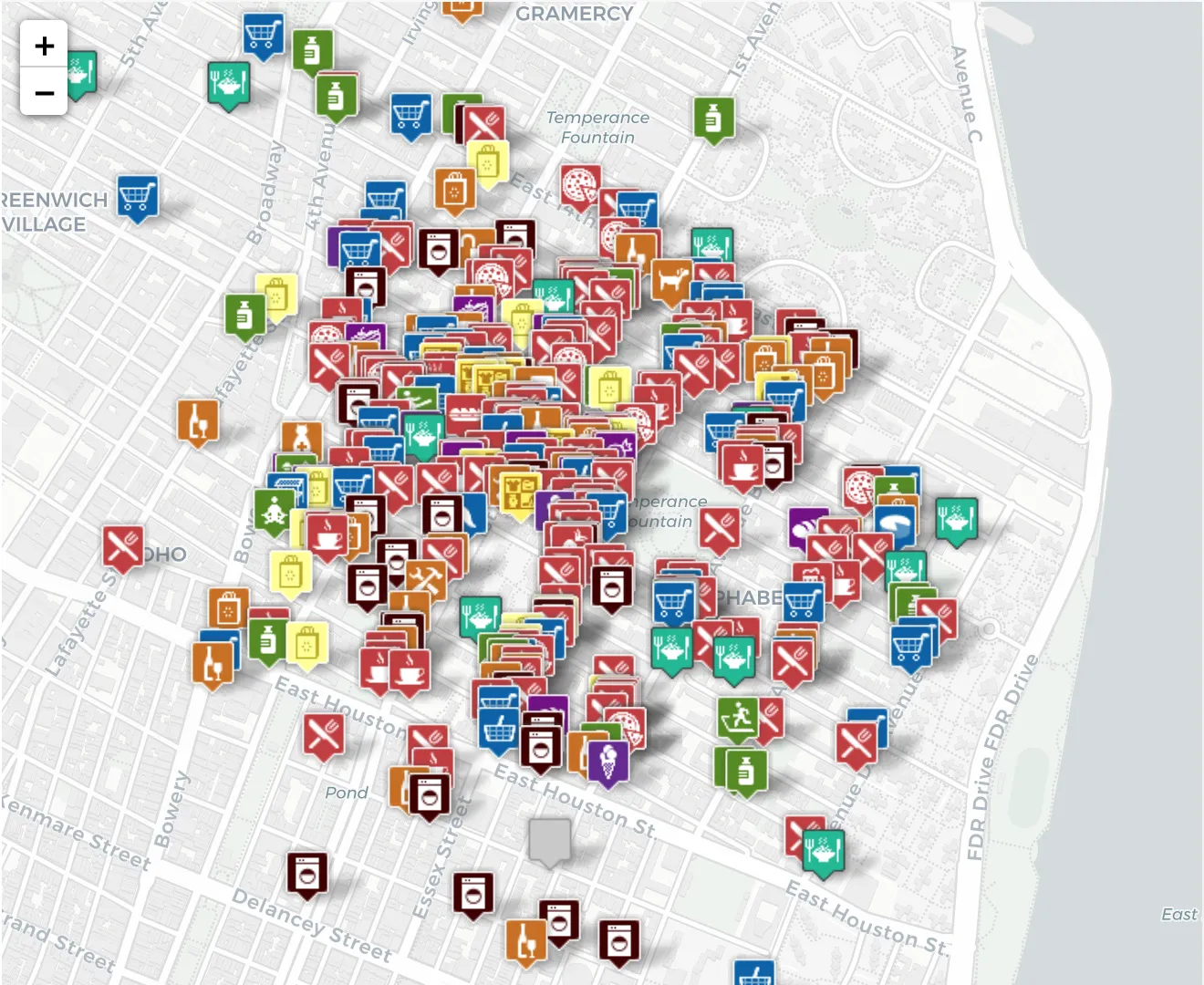
The East Village Community Coalition launched an interactive map of independent local businesses in the East Village, broken down by categories to narrow down your options. Their neighborhood-wide database of businesses include groceries, laundromats, restaurants, dessert, retail, shops and free food.
Once you click on a location, you can see details about whether the business is offering delivery or takeout, its hours, and their phone number and address. To add a small business that's open, and offering anything from food delivery to products available for purchase online, you can fill out a form in this google doc.
If you're located in the Upper West Side, you can find restaurants that are still offering delivery and takeout in a map by West Side Rag.
For Brooklynites, Tastes of Brooklyn, known for its annual food festival where visitors sample dozens of local restaurants, created interactive maps of the borough's robust neighborhoods. "Over the past year, we have been eating and sipping and doing good across Brooklyn, walking and exploring new culinary gems in Tastes of Brooklyn food and drink crawls," they wrote on their website. "Now...restaurants and bars can no longer operate as they once did. We want to show gratitude. So, we've created interactive maps to show you who's open for takeout and delivery."
Whether you live in or like to dine and drink around Carroll Gardens, Cobble Hill, Bushwick, Crown Heights, Bay Ridge, Park Slope, Red Hook, Flatbush and Gowanus, they have already created maps for each of those areas.
Within the Carroll Gardens, Cobble Hill and Boerum Hill map, you can see famous joints open like old school classic Paisanos Butcher Shop, Middle Eastern grocery Sahadi's, and one of our favorite restaurants Ugly Baby, for those looking for some spicy bites.
In their Crown Heights map below, other amazing restaurants and bars like Chavela's, Hunky Dory, Barboncino Pizza, Gloria's Caribbean Cuisine and beer paradise Covenhoven, are all marked as open and along the left, you can find handy information about their hours of operation.
This week, they added a map of what's currently open in Fort Greene (shown below) to their site. A few callouts include Latin American wine bar Colonia Verde, Mediterranean restaurant Miss Ada, cocktail bar Sisters and neighborhood Italian spot Aita.
Tastes of Brooklyn also announced they will soon be launching interactive maps for several other popular neighborhoods too including Dumbo, Prospect Heights and Sunset Park, so stay tuned.
As for Greenpoint and Williamsburg, North Brooklyn Neighbors is crowdsourcing this map, so you can keep up with open grocery stores, laundromats, food pantries and restaurants. You can also submit information on local venues here.
This article has been updated from its original with new information.
Most popular on Time Out
- Millions of free face coverings are being distributed across NYC this month
- You can download over 200 art books from the Guggenheim for free
- The Metropolitan Opera streams a new lineup of free performances every night this week
- The best live theater to stream online
- Ellis Island will now personally help you research your ancestors