
[title]
Apparently some of you weren’t impressed by our entirely serious suggestion that Glastonbury should move to London. Reactions included ‘get over yourself’, ‘get a grip’ and ‘come up with your own fucking festival’. (We have a couple already – cheers though!)
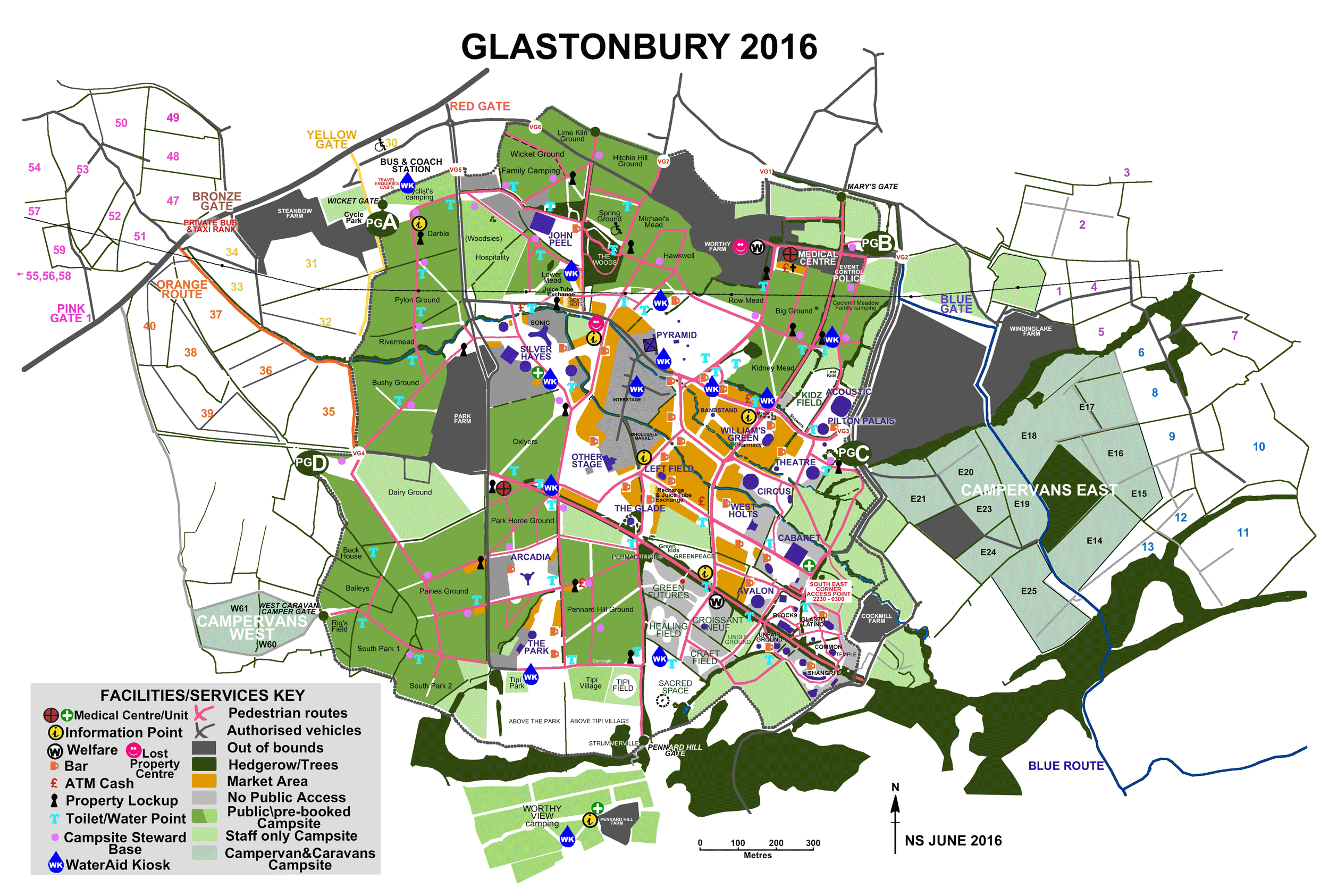
The thing is, London and Glastonbury have a lot in common. They’re both complex, chaotic, expansive cities that can be tricky for regular visitors to navigate, let alone newcomers. In London, the best way to visualise all that mess is the tube map (#iconic). So we thought: why not do the same for Glasto?

Click here for the full-sized map
Our Glastonbury tube map is based on the official site map, and includes all the major stages, areas and campsites. It uses some of the design principles of the tube map, simplifying the festival’s actual geography to make the connections between different places a bit clearer. If you’re lucky enough to have a Glasto ticket then make sure to print off a copy: it could make all the difference when you’re stumbling back from Shangri-La to Row Mead at 2am. And maybe laminate it too – we’ve got a feeling it’s going to be a rainy one this year…
Into festivals? Check out our music festival calendar. Into weird tube maps? Check out the best ones of 2015.