[category]
[title]
The new 17-kilometre corridor is officially open, along with new cycling trails and more than eight hectares of open public space


There’s a lot going on underground in Melbourne. Just last month, the Metro Tunnel started zipping passengers across the city, and now, the city’s brand-new artery has officially opened. On the morning of Sunday, December 14, the long-awaited West Gate Tunnel officially opened to traffic – marking the biggest road infrastructure milestone since CityLink launched back in 1998.
Designed as a vital alternative to the ever-strained West Gate Bridge, the West Gate Tunnel gives drivers a new choice when travelling in and out of the city. For the more than 200,000 vehicles that use the West Gate Freeway every day, that means quicker, safer and more reliable journeys – with fewer bottlenecks, less weaving and a whole lot less stress.
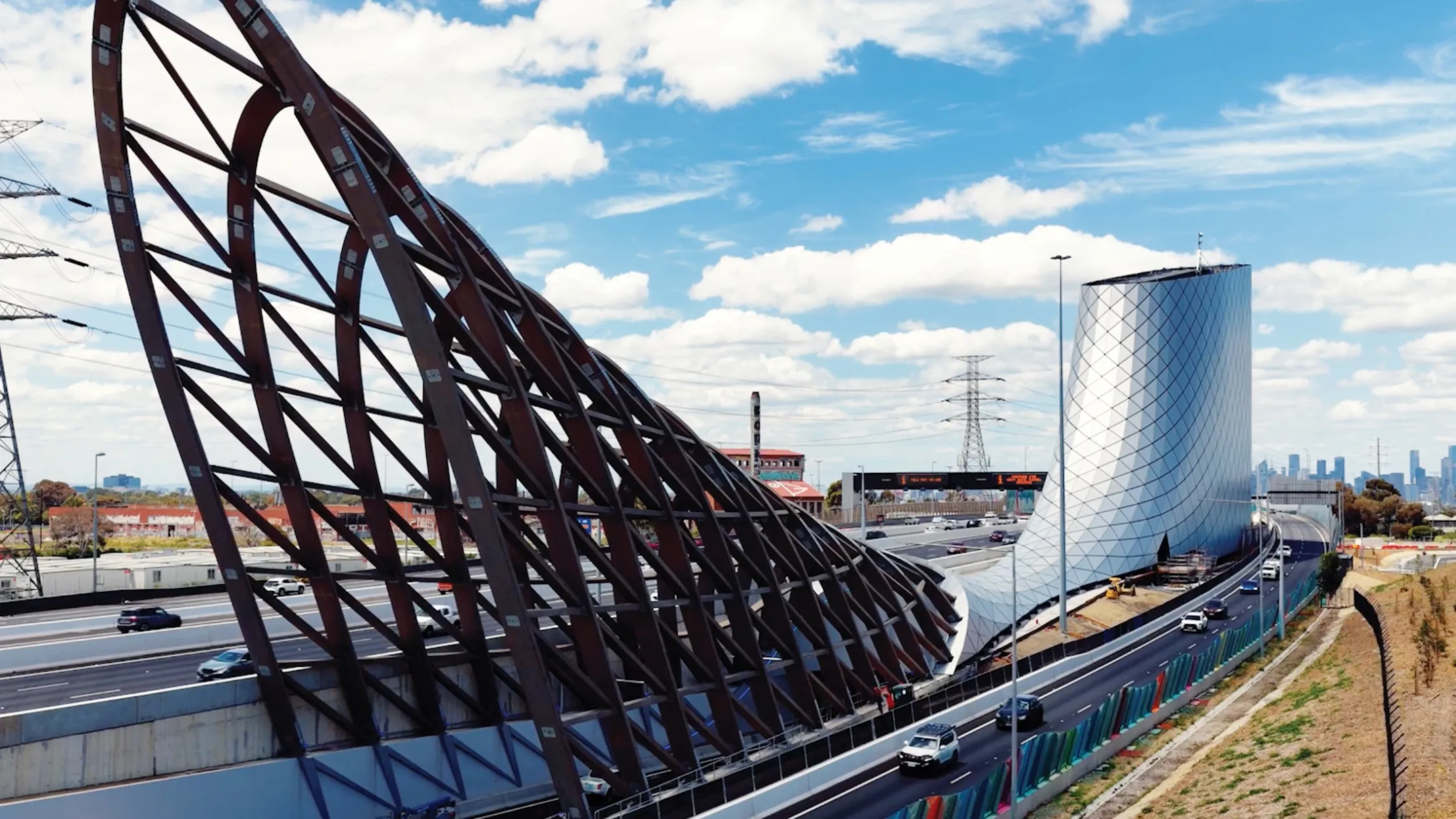
At its core is a 17-kilometre corridor of seriously impressive engineering: twin underground tunnels running from the West Gate Freeway to Yarraville, connecting to a new bridge over the Maribyrnong River, plus ramps, elevated roadways and a significantly widened freeway. The West Gate Freeway itself has expanded from eight to 12 lanes, including new express lanes between the M80 Ring Road and the bridge – a move designed to smooth traffic flow and slash congestion.
The new route into the city is a major bonus, but the most welcome change for locals is arguably what the tunnel will take away. More than 9,000 trucks a day have been removed from residential streets in the inner west, redirected instead through direct connections to Melbourne's port via Mackenzie Road, Appleton Dock Road and Hyde Street. It’s a freight game-changer – and a quality-of-life upgrade for neighbourhoods long used as smoke-choked rat runs.
And crucially, one of the project’s biggest wins is for cyclists, walkers and joggers – with more than 14 kilometres of new and upgraded paths now completed and opening alongside the tunnel. The Federation Trail is finally whole, with missing links built and existing sections rebuilt, and it's joined by a new walking and cycling bridge over Williamstown Road, plus the Hyde Street ramp path, Hall Street path, Stony Creek open space links and even a BMX jumps track. What does that mean? Safer, greener routes and almost four MCGs’ worth of new open space stitched into the west of the city.
Smart technology will keep things ticking along underground, with 24/7 traffic monitoring, rapid incident management and design features focused on safety and efficiency. Above ground, the project leans into world-class architecture, with urban and landscape design inspired by the Aboriginal heritage and maritime history of Melbourne’s west – layered with thousands of new trees, shrubs and grasses to green the corridor.
You can learn more about the project and plan your route (or your next bike ride) over here.
Stay in the loop: sign up for our free Time Out Melbourne newsletter for the best of the city, straight to your inbox.
Discover Time Out original video