[category]
[title]
More than a decade in the making, the Munjip Trail (just 4 hours south of Sydney) features stunning coastal views and stories from Traditional Owners


The hiking scene in NSW is on the up and up. Thanks to the Great Walks initiative, new trails are opening up across the state, ranging from epic multi-day mountain routes to small, remote tracks connecting beautiful, secluded beaches. The Grand Cliff Top Walk opened in early 2024 in the Blue Mountains, and in the summer of 2024, the Snowies Alpine Walk was completed – an incredible four-day hike tracing mountain valleys and Australia’s tallest peak. So far this year, we’ve seen an impressive 42-kilometre hike through the Byron hinterland join their ranks, along with a 20-kilometre coastal hike on the NSW South Coast. Now, we’ve got a new hiking story to share – with the Munjip Loop open now, just a few hours south of Sydney.
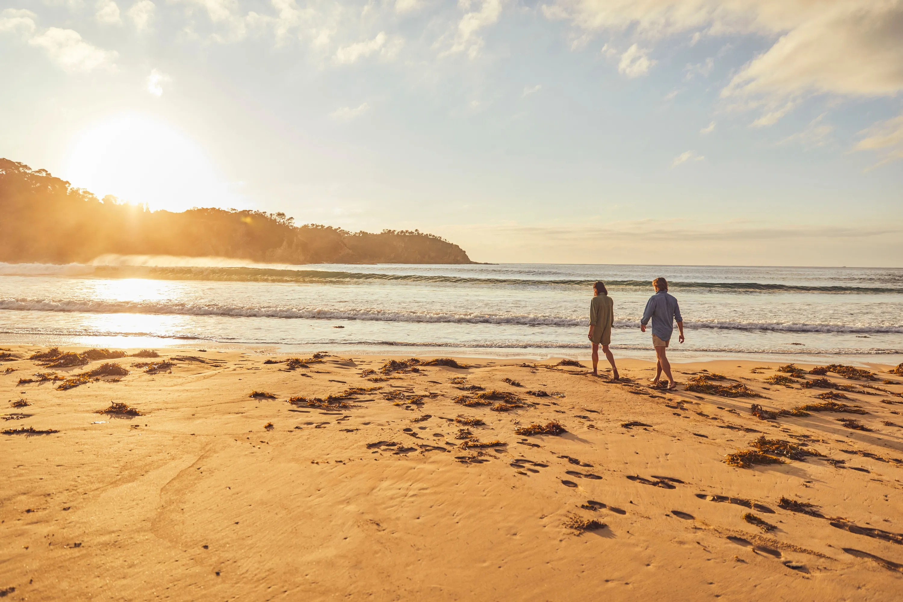
The Munjip Trail is a 15-kilometre coastal walk in the NSW South Coast region, tracing stunning coastlines and beautiful native bushland. The project was born way back in 2010, and after the devastating bushfires of 2019 ripped through the region, the Eurobodalla Council (with support from the Bushfire Local Economic Recovery Fund and other local community funding bodies) invested $6.5 million in upgrading the walking trails between Batehaven and McKenzies Beach, allowing locals and visitors the chance to explore the region’s magical coastline. The name ‘Munjip’ reportedly translates to “walking together, let’s go” in the local Dhurga language. To honour the heritage of the area, you’ll find signage, artwork and audio guides along the trail sharing stories of the traditional custodians of the land and waters. And to make your walk a truly immersive experience, the Eurobodalla Council has launched an interactive map that will help you plan your adventure and learn about the area as you go.
The Munjip Trail is located in the Eurobodalla region of NSW, around a four-hour drive south of Sydney. The trail extends from Batehaven to McKenzies Beach, with the starting point at Batehaven about seven minutes’ drive from the centre of the coastal town of Batemans Bay. The trail finishes 15 kilometres down the coast at McKenzies Beach, after tracing the clifftops past several stunning beaches (including the picture book-perfect Malua Bay).
The trail stretches for 15 kilometres along the beautiful Eurobodalla coastline, taking in dramatic headlands and dreamy hidden coves as well as some more urban stretches. If you venture to every optional lookout along the route, you’ll be walking 18 kilometres in total – and we’d say it’s worth opting in for those extra three kilometres for the views alone.
Without stops, the hike takes around five hours to complete – but it’s not the kind of walk you want to rush. We’d recommend driving down south the day before and spending the night in the area, so you have the whole day to enjoy the hike and splash around in the beaches you pass along the way.
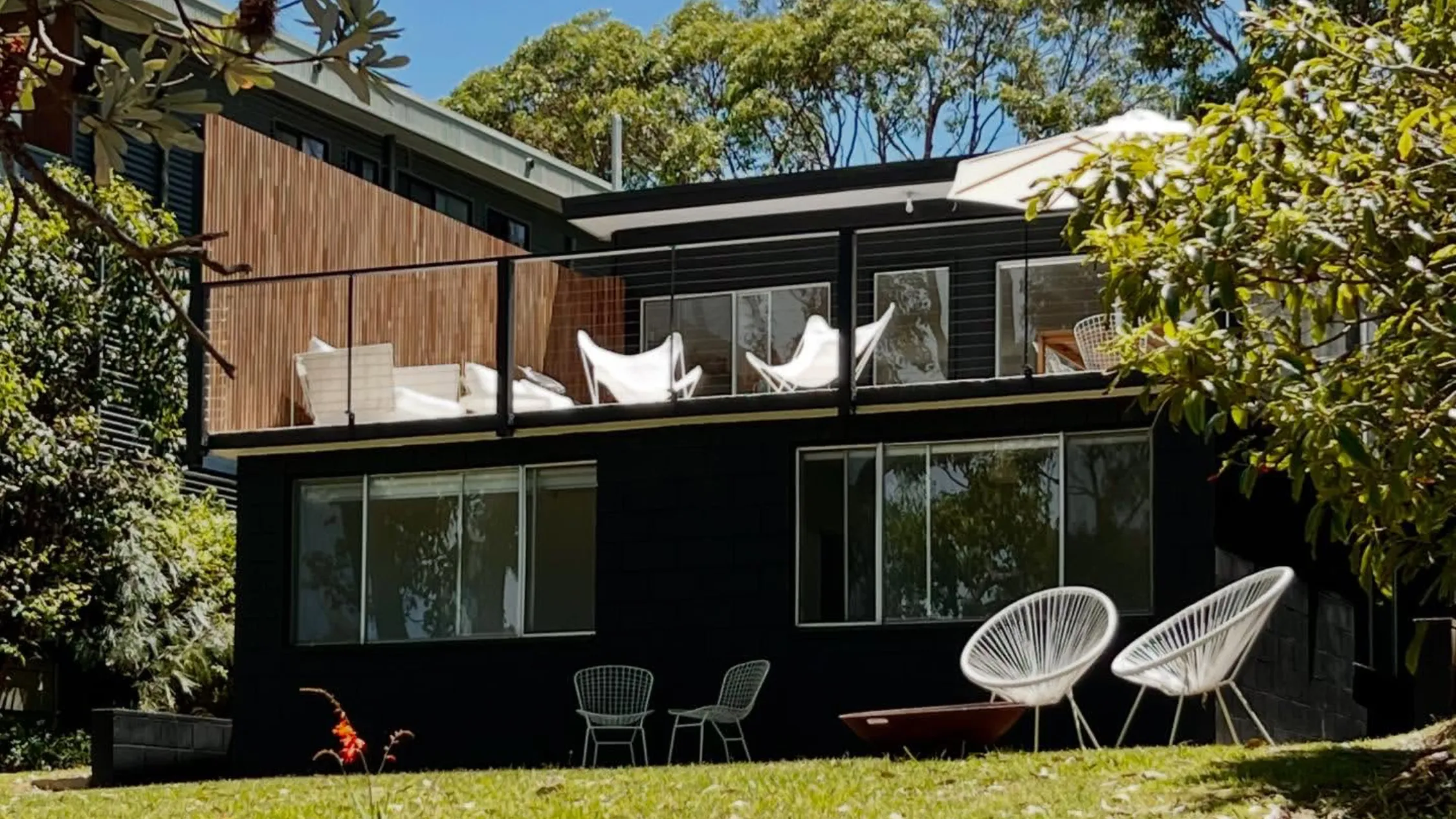
Our top pick for accommodation nearby is Shelter: a beautifully restored 1970s beach shack overlooking the waves at Malua Bay (just a few sandy steps away from the trail). With an outdoor shower, sun-soaked deck and carefully curated record collection, it’s the perfect base for your indoor-outdoor South Coast escape.
There’s no need to book to do the hike itself, but it’s worth booking accommodation in advance. It's also worth thinking ahead when it comes to transport – either make sure you have a pick-up arranged, leave a car a the end point at McKenzies Beach or double-check the local bus timetable to make sure you can get to where you need to be once you've completed the trail.
You can learn more and plan your adventure over here.
Stay in the loop: sign up for our free Time Out Sydney newsletter for more news, travel inspo and activity ideas, straight to your inbox.
Discover Time Out original video