[category]
[title]
A guide to tackling one of the city’s most famous routes


Spanning nearly 100 kilometres across the New Territories, the MacLehose Trail is easily one of Hong Kong’s most iconic hiking routes. Starting in Sai Kung, it cuts from east to west across eight country parks all the way to Tuen Mun, serving up some seriously spectacular views along the way. Ready to hit the trail? Bookmark our guide to help you navigate this epic outdoor adventure.
If you want to start from the absolute beginning of the MacLehose Trail, the trail begins at Pak Tam Chung – though some might not exactly call this proper hiking since you’ll be on paved roads for this section. You can get there by taking a taxi from Hang Hau MTR station, or get on the 101 minibus to Sai Kung Pier first before taking a taxi there.
From Pak Tam Chung, follow Tai Mong Tsai Road until it turns into Sai Kung Man Yee Road. This opening stretch is paved, mostly flat, and follows the edge of the beautiful High Island Reservoir. Continue along the main winding road, which will bring you straight to the High Island Reservoir East Dam, where Section 1 ends and Section 2 begins. If you’re up for some exploring, keep an eye out for small trails along the way that branch off to various Hakka village ruins.
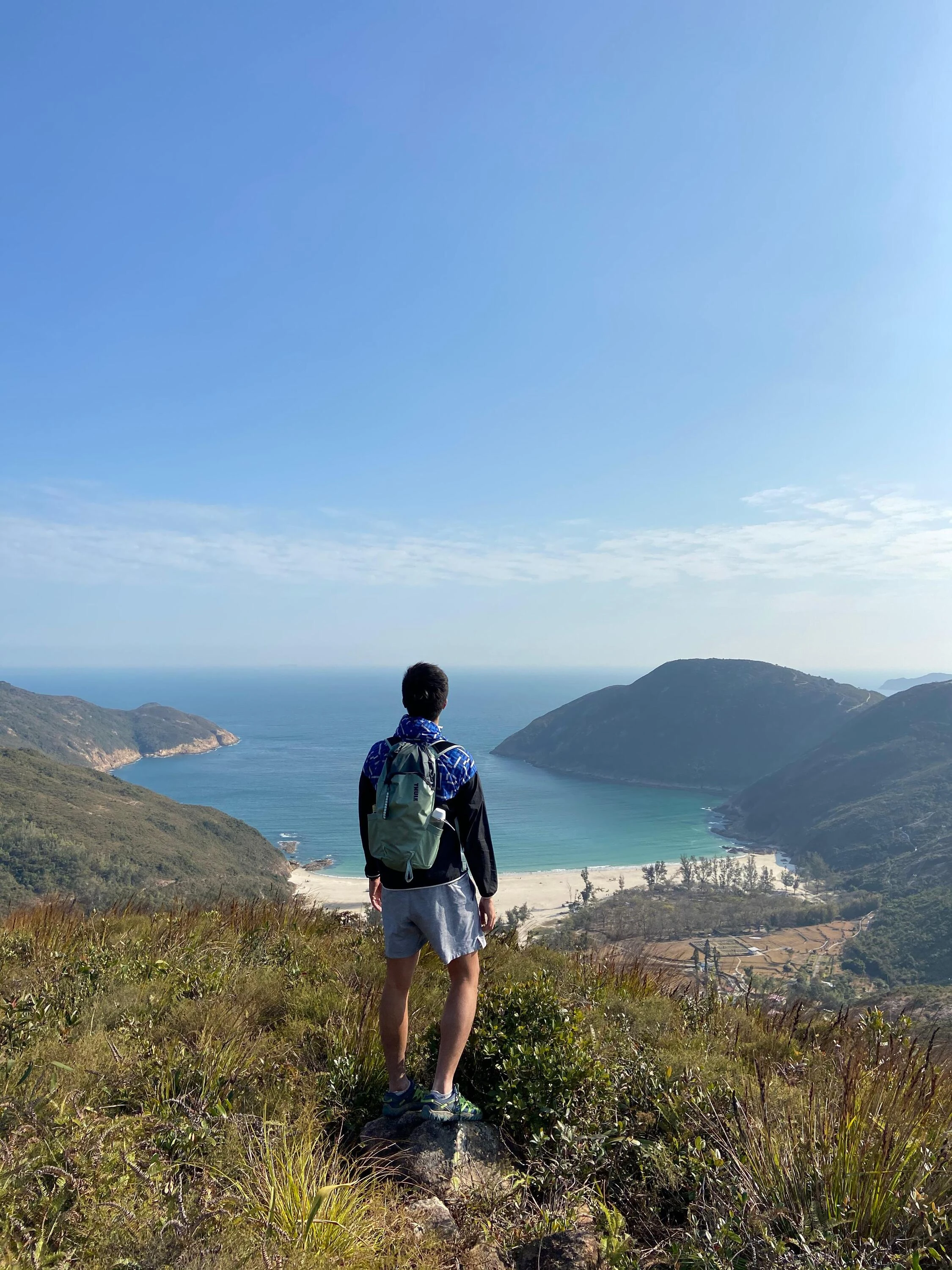
Continuing past the East Dam, the path shifts from smooth tarmac to a more rugged trail, dropping you down into the stunning Long Ke Wan. After enjoying the sands, you’ll face the hike’s biggest challenge of ascending Sai Wan Shan. Though the steep incline and descent will test your legs, the reward at the top is a picture-perfect view of Sharp Peak rising over the beaches.
For the descent, follow the winding mountain path down until you hit a concrete intersection. If your legs are shot and you want to call it a day, turn left for a short walk that leads straight to Sai Wan Pavilion, where you can hop in a taxi or wait for the NR29 village bus back to Sai Kung town centre, but do keep in mind that the bus schedule here is highly sporadic.
If you have energy to spare, turn right instead to continue down to the coast. This path brings you into the idyllic village of Sai Wan where you can stop for a quick snack and a cold drink. From there, cross the sand and climb over the next headland to reach Ham Tin Wan, one of the region’s most spectacular white-sand beaches. After taking in the views, walk over to the far end of the beach and cross the bridge to rejoin the main trail. From here, the path transitions into a steady concrete incline up towards Tai Long Au before winding along the mangroves of Chek Keng. One final, gradual uphill push through the trees brings you to the official end of Section 2 at Pak Tam Au, where you can easily jump on a bus or grab a taxi back to town.
Stay in the loop: Sign up for our free Time Out Hong Kong newsletter for the best of the city, straight to your inbox
Recommended stories:
See how this young artist blends pop culture and Hong Kong tradition in mahjong art
Gokan’s latest cocktails shine light on beloved Japanese flavours
New Argentinian steakhouse and wine bar Don Pedro opens in Sai Ying Pun
Discover Time Out original video