Get us in your inbox

Search
Two walkers on the Barrenjoey Lighthouse Track
Photograph: Wild About Whales

The best walks in Sydney

Sydney’s walking trails have some of the best views in the city

Written by
Emma Joyce
,
Olivia Gee
&
Winnie Stubbs
Advertising

From easy breezy coastal walks to half-day bush hikes and multi-day expeditions, Sydney is blessed with many different walking paths that’ll suit amblers of all abilities.

As fans of anything that allows us a different vantage point of our city (rooftop bars included), our editors have rounded up their favourites.

Take a look at our list of 13 walks in Sydney that’ll take you over dramatic sandstone cliffs, cobbled stone paths, sandy inlets and well-trodden boardwalks. Take your camera to capture city skyline views, kookaburras sitting in old gum trees, Australian water dragons basking in the sunlight and preserved and protected Aboriginal engravings dating back thousands of years.

View of Manly beach
Photograph: Supplied | Destination NSW

Feel like cooling off? We've ranked the best beaches in Sydney.

Sydney's best walks

  • Sport and fitness
  • Walks
  • Rose Bay

How far? 1.8km

How long will it take? 30 minutes

Why go? It’s a quick stroll, but this walk was made for lengthy pit stops – picnics, photo ops and swims – at scenic beaches overlooking the harbour. Park the car at Bayview Hill Road or Nielsen Park and do a return trip to make the most of it. The route is either paved or timber boardwalk, and it’s relatively easy going (though there are steps along the way).

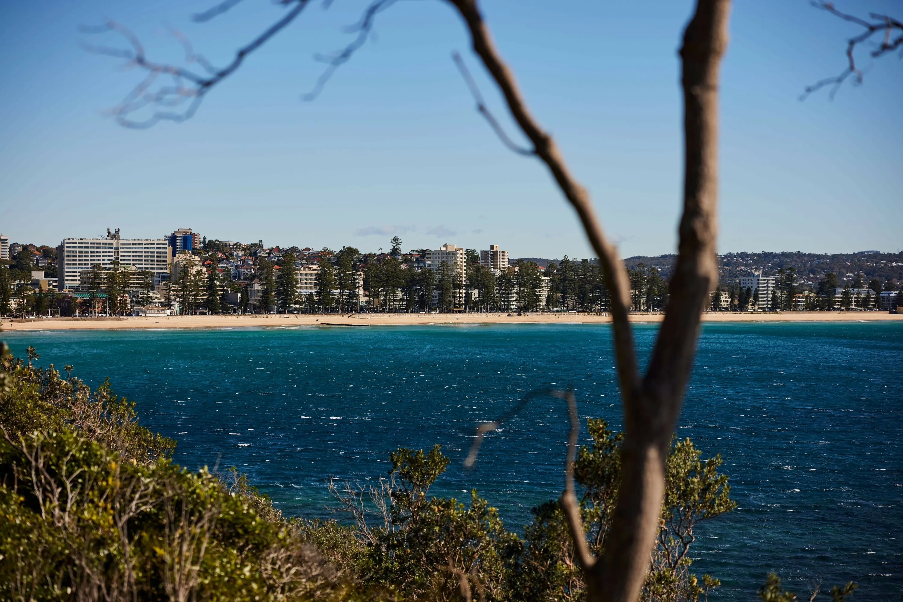
What’s to see? Besides the million-dollar mansions, you’ll be greeted with panoramic views, including the Harbour Bridge, Opera House and Shark Island. There are benches and rock faces, where walkers stop for that perfect Instagram shot. You’ll walk by the picturesque Milk Beach, past the heritage-listed Strickland House and to the turquoise waters of Parsley Bay. As of 2022, the beautiful Shark Beach has been closed for construction work – it's due to open any day, so check here for updates.

Should you pack snacks? Yes, it’s picnic heaven. However, the kiosk at Parsley Bay does an excellnt line in pastries, toasties and icy poles to keep you refuelled and refreshed.

  • Sport and fitness
  • Walks
  • Balgowlah Heights

How far? 10km

How long will it take? 4 hours

Why go? The route takes you from sandy coves to beautiful vantage points of Sydney Harbour, up and down rocky staircases, and to at least four secret beaches.

What’s to see? You’ll need to keep an eye out for the signs, but at the highest point of the climb you can see Aboriginal rock engravings of a kangaroo, a whale and small fish at Grotto Point. Castle Rock beach is postcard perfect, so bring your swimmers and a towel as you’ll want to spend time by the crystal-clear water at the otherwise hard-to-reach beach in Middle Harbour.

Should you pack snacks? Definitely bring water and proper sun protection, as there are very few water fountains and limited shade. However, you may want to make a day of it with lunch at Queen Chow in Manly or Chiosco by Ormeggio, a short walk over Spit Bridge.

Advertising
  • Sport and fitness
  • Walks
  • Mosman

How far? 4km

How long will it take? 1.5 hours

Why go? The denser bush along most of this track makes it feels like you’ve travelled much further away from the city than you really have. The weaving trail is either boardwalk or dusty, leafy path, and you’re likely to spot curious water dragons along the way. The area was a meeting point for the Borogegal clan of the Eora nation before colonisation. Today it’s named for the Lieutenant Bradley of First Fleet ship HMS Sirius.

What’s to see? Start the track near Taronga Zoo and from Athol Bay to the HMAS Memorial Mast you’ll have sweeping views over to Sydney Opera House, the Harbour Bridge and the PM’s residence. From Taylors Bay round to Chowder Head you’ll be able to spot Shark Beach and a sliver of Watsons Bay. Once you reach Clifton Gardens Reserve you can sit and watch the boats go by from the little kiosk by the beach.

Should you pack snacks? The hole-in-the-wall kiosk at Clifton Gardens is not always open so bring lunch. Take a water bottle too as bubblers are scarce.

  • Sport and fitness
  • Walks
  • Bondi Beach

How far? 6km

How long will it take? 2.5 hours

Why go? It’s not the most challenging walk in the Sydney area, but it’s one of the most popular – and for good reason. That coastline is spectacular from every direction, and you’re in a pretty urban environment so it’s one you can do on a whim – though it’s best to avoid peak tourist season and the midday sun. No matter what distance you choose, activewear is always welcome.

What’s to see? The full stretch takes you by Waverley Cemetery, where it can get windy through the suspended walkway. Find there the secluded nook that is Gordons Bay, a good place to swim and snorkel. And you’ll pass several ocean pools and local swimming spots – especially Bronte Pool, around the concreted Clovelly inlet and Coogee’s rock pools.

Should you pack snacks? Even if you live by a strict plant-based diet, you can leave the house knowing you’ll find plenty of breakfast options in Bondi, plentiful kiosks along the route, and the option to hydrate with hops and barley at Coogee Pavilion. There are plenty of water fountains and toilets, too.

Advertising
  • Sport and fitness
  • Walks
  • Sydney

How far? 13.4km one way

How long will it take? 3.5 hours

Why go? Your heart will be racing with the steep inclines, rocky cliff faces and spectacular views of the Hawkesbury River and serene Jerusalem Bay. It’s an adventurous trail, as part of the Great North Walk, with smooth boulders to squeeze through and metal pegs to clamber up/down. Bring your best boots and metal poles to help steady yourself on the sandy surfaces as you head downwards. 

What’s to see? We suggest starting at Brooklyn where you’ll hit a brutal uphill fire track straight away. The sweaty start gets you high up above the glittering water of the Hawkesbury, which you’ll spy from every angle, including Dangar Island and the boats travelling to and fro. Closer to your sightline there’ll be bright bottlebrush flowers, spiky banksia pods, and lush green foliage either side of the dusty path.  

Should I pack snacks? If you’re starting at Cowan, you can reward yourself with Fitzies’ fish and chips at the finish line, but there’s very little open once you reach Cowan Station. Bringing your own water is a must. The nearest toilets to the walk are at Brooklyn Train Station. 

  • Things to do
  • Walks and tours
  • North Parramatta

How far? 4.2km circuit

How long will it take? 2 hours

Why go? Two kilometres from Parramatta CBD is a man-made reservoir on 75ha of parkland. The lake is a popular swimming spot, and visitors can hire pedal boats or kayaks to explore the area on water. It was once a meeting place for the Darug people, and now there are three marked walking trails that join into one long track, circling the lake. It’s an easy to moderate walk and dogs are welcome if they’re on a lead.

What’s to see? You’ll hear the cockatoos before you see them, but there are also lots of rosellas and kookaburras among the red gum trees and banksias. It’s an uneven pathway, and you’ll get to cross the creek twice, as well as check out the 1856-built Parramatta Dam.

Should you pack snacks? Yes. The park has free barbecues and a playground, so you could make a family day of it. For the less organised, there’s a kiosk called Lake Parramatta Café serving up burgers, wraps and sandwiches.

Advertising
  • Things to do
  • Palm Beach

How far? 2km return

How long will it take? 1 hour

Why go? It’s a strenuous trek up a steep sandy trail, with steps and rocky lookout points, but the sweaty ascent is short and the views at the top are well worth it. As you’re climbing, look back at Palm Beach on the left (east) and Pittwater to the right (west). There is an access trail, which cuts out some of the climb but is still steep and narrow.

What’s to see? The 1800s lighthouse sits at Sydney’s northern-most point, Barrenjoey Head, so at the peak you’ll have spectacular views over Hawkesbury River and Broken Bay. In wintertime you can spot humpback whales as they migrate south. You can also tag onto a guided walk of the lighthouse every Sunday (every 30 minutes from 11am-3pm; $2-$5).

Should I bring snacks? Only if you’re hunkering down for whale migration season. This is a swift walk that requires a few catch-your-breath breaks, so we suggest refuelling at the Boathouse Palm Beach to reward your efforts.

  • Sport and fitness
  • Walks
  • Sydney

How far? 12.9km one way

How long will it take? 6 hours

Why go? This is the kind of trail you need to prepare for: wear sturdy shoes, expect wet and dry ground, and take plenty of drinking water for those never-ending stairs. It’s exciting when you have to use stirrups to maneuver up and down rocks, or rely on fellow walkers for support as you cross uneven ground. Make a day trip of it and you’ll want to return for that first glimpse of Berowra Waters as you complete one hard uphill climb.

What’s to see? Once you’ve scaled the steps heading towards Berowra train station, there’s an expansive lookout point with a bench for a well earned rest. Naa Badu Lookout has spectacular views of the waters meeting at Berowra, Sams and Calna Creeks. Naa Badu means ‘see water’ in Dharug.

Should I pack snacks? Absolutely. There are limited options by the station in Cowan, and if you’re lucky the little Italian bistro, A Chef Secrets (by the ferry), will be open and serving takeaway coffees. Note: there’s only one public toilet on this route.

Advertising
  • Sport and fitness
  • Walks
  • Parramatta

How far? 65km 

How long will it take? Two to five days, depending on your speed and endurance.

Why go? Have you ever been driving to the foothills of the Blue Mountains and thought “hey, I’d love to hike this trip”? Well, now you can, because the final path has been laid on the Great West Walk. The relatively flat 65-kilometre route opens up a glorious patchwork of Western Sydney landscapes, from the station exit at Darcy Street onto Parramatta Park, through the protected Cumberland Plain woodland and part of Western Sydney Parklands, then stretching to the Nepean River and finally the mountains.

What's to see? If you were to take on the whole walk in one outing, you’d weave through dense thickets, along babbling creeks, past colonial structures and even through shady suburban lanes. But luckily you can approach it in bite-sized strolls, with the Western Line trains stopping frequently along sections of the trail. For more details on trail highlights, places to pause for a wee and water, and other trip details, be sure to keep this info kit handy.

Should you pack snacks? You’ll want to be well stocked, but if you do run low on food and water reserves, there are many shopping opportunities along the length of the walk as it weaves through populated areas like Seven Hills, Blacktown, Rooty Hill and Jordan Springs.

  • Sport and fitness
  • Walks
  • Sydney

How far? 4.4km loop

How long will it take? 2.5-3.5 hours

Why go? Firstly, that view from West Head lookout point. If you’ve arrived by car, it’s a short walk to the lookout where you can see across to Barrenjoey Lighthouse, over Pittwater and around to Broken Bay. It’s a site busy with cyclists, families and romantic selfies. Walk to Resolute Beach, a secluded sandy cove that you can only reach on foot or by boat. Bring swimmers and a towel – you’ll want to linger here before starting the thigh-burning trek back.

What’s to see? You’ll walk by Red Hands Cave, which is where you’ll see engravings and ochre hand markings made by the Guringai people, thought to date back 2,000 years. It’s one of 350 identified Aboriginal sites in the Ku-ring-gai Chase National Park.

Should I pack snacks? Yes. It’s a one-hour drive to West Head from Sydney CBD, and you’ll need to pay a $12 vehicle entry fee to access the park – so make the most of your time and bring a picnic to eat at Resolute Picnic Area. BYO water – there’s no running water supply here, which goes for the loos too.

Advertising
  • Sport and fitness
  • Walks
  • Watsons Bay

How far? 2.8km return

How long will it take? 1 hour

Why go? It’s an easy amble that you can tack onto a day at the beach. Starting at Watsons Bay ferry terminal, follow the footpath along the beach to the calm waters of Camp Cove. From there, you’ll walk along cobbled stone paths up to the historic lighthouse, a lightkeeper’s cottage, and past old military cannons and sandstone gun emplacements.

What’s to see? Standing beside the 1858-built red-and-white striped lighthouse, you’ll be in a prime spot to see across the harbour mouth to North Head and back towards the city. You’ll also pass one of Sydney’s official nudist beaches, Lady Bay Beach.

Should I pack snacks? There are plenty of eateries nearby, including the famous fish and chips kiosk Doyles and the popular sundowner spot Watsons Bay Boutique Hotel.

  • Sport and fitness
  • Walks
  • Kurnell

How far? 12km

How long will it take? 4.5 hours

Why go? Those without private wheels can jump on the 987 bus from Cronulla Station and start the trek from the Polo Street stop. You’ll be starting on the service trail as you head south-east around the Kamay Botany Bay National Park gates, but will gradually encounter sandy bush tracks and more defined coastal cliff paths with incredible views out towards the ocean. Amblers who enjoy a challenge will be well served here; some sections of the trail are unmarked and a little rugged, so bringing a map and some forward planning is wise. 

What's to see? Once you get beyond those stunning ocean cliffs and a few lush swampy environments, you'll encounter the Cape Bailey Lighthouse then head down towards the Boat Harbour Aquatic Reserve. After that, it’s a matter of keeping the ocean to your left and meandering along the sand. 

Should I pack snacks? The fine eateries of Cronulla can certainly provide the post-hike edible goods, but if you like to munch carrot sticks at the halfway point, the lighthouse is a perfect snack pit-stop.

Advertising
  • Sport and fitness
  • Walks
  • Bundeena

How far? 6.8km return

How long will it take? 2 hours

Why go? This is just a slice of the spectacular Coast Track – a 26 kilometre, two-day hike hugging the sandstone cliffs of the Royal National Park. It’s beautiful from every direction, but if you’d like to park the car and return by lunch it’s best approached from Bundeena.

What’s to see? Starting at Beachcomber Avenue in Bundeena, the well signposted walk is made up of rugged clifftop flats and steep, rocky stairs. It’s a popular walk year round, and the fragile, white rock formation known as Wedding Cake Rock is now fenced off to stop people risking their lives for an Instagram shot – look, don’t touch. If you’re here to spot whales, aim for late June/early July for the best chance of seeing breaching humpbacks.

Should I pack snacks? Once you enter the park there’s limited phone reception or toilet facilities, so pack what you’ll need for the hike: water, snacks and sun protection are entry-level sensible.

Recommended
    You may also like
    You may also like
    Advertising